

We conduct urgent research into climate, air quality and ecosystem impact. Earth’s climate is changing because of manmade greenhouse gas emissions. Carbon dioxide and methane are the two main contributors to the enhanced greenhouse effect. Aerosols cool the Earth by scattering and through cloud formation, but it is uncertain by how much. Global warming can trigger tipping points in the Earth’s ecosystem; we study for example permafrost thaw, wildfires and climate-cloud relations.
Earth
-
Methane

-
CO2
-
Carbon monoxide
-
Aerosols and Clouds
SRON Earth Programme
SRON is the Dutch national expertise institute for space research, as part of the Dutch Research Council (NWO). In the Earth Observation program, we contribute to research on climate, air quality and its consequences for biodiversity by working on the entire chain of space missions. We develop key detector technologies, design and realize instruments in collaboration with partners, and develop analysis tools and models to make the data applicable to users. SRON also provides council to the government on scientific space use.
Key expertise in atmospheric composition
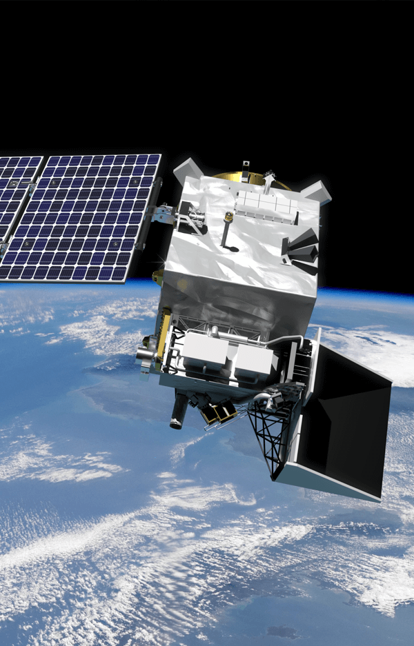
The Earth Observation program at SRON has key expertise in monitoring atmospheric composition. This expertise was developed over the past decades in a Dutch ecosystem of universities, knowledge institutes, and industrial partners. The Netherlands is world-leading in atmospheric composition monitoring with a series of instruments such as TROPOMI on ESA’s Sentinel-5p mission and SPEXone on NASA’s PACE mission.
The UN climate panel warns that our warming climate, caused by human-made emissions, puts the global ecosystem at risk. Several climate tipping points could be triggered this century, leading to large and irreversible changes to the climate system and large impacts on society. This confronts our society with urgent scientific questions about climate change, air quality, and its consequences for biodiversity. In answering these questions, scientists, governments, and international bodies increasingly rely on earth observation data. Satellites are vital because they provide global and intercomparable information that can be available within hours after sensing (e.g. shortly after a pipeline leak) and can also provide time series spanning decades of calibrated and validated data of greenhouse gas concentrations and inferred emissions.
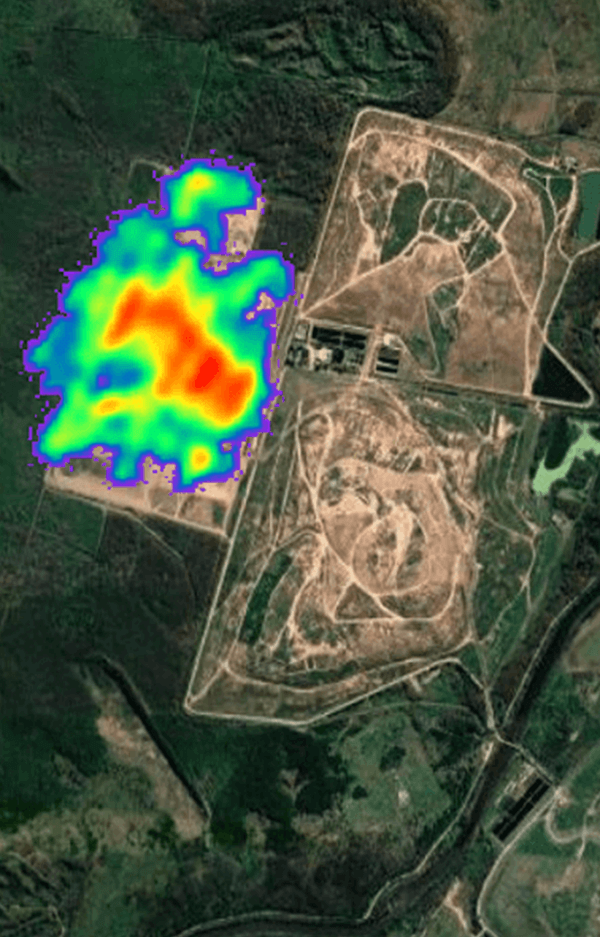
Moreover, constant advances in satellite instrumentation make observations with an ever-increasing detail possible. For example, SRON scientists have recently used satellites to spot large methane plumes from individual waste dumps for the first time from space [Maasakkers, Science Adv. 2022].
For the United Nations Methane Alert and Response System (MARS), together with our partners we design a rapid methane hot-spot detection system using satellite observations. This will provide actionable information to reduce emissions of this strong greenhouse gas and curb climate change.
SRON’s Earth Observation program focuses on:
– CO2 and CH4, the two most important greenhouse gases;
– Aerosol, relevant for human health and global warming;
– Aerosol-cloud interactions, a very uncertain but important process affecting global climate;
– Wildfire emissions, with impact on climate, air-quality, and our global ecosystems.
By contributing to the development of earth observation space missions, SRON takes part in the fulfillment of government policy on Climate & Environment and Science & Education. On the European level, we contribute to Horizon Europe and Copernicus. Internationally, we develop missions together with NASA, contribute to the United Nations Environment Program and facilitate climate action in collaboration with non-governmental organisations such as EDF and GMH.
SRON's Earth Experts
-
 Read more
Aaldert van Amerongen
Head of the Earth Observation Program (Dr.)

Satellite data for the global atmosphere
The Earth’s climate is changing because of man-made greenhouse gas emissions. Carbon dioxide and methane are the two main contributors to this enhanced greenhouse effect. Where are those gases emitted? Where do they go from there? How will these processes of emission and absorption be influenced in a changing climate? What is the role of various types of aerosols? Here you find maps with satellite data and software packages to help answer these questions.
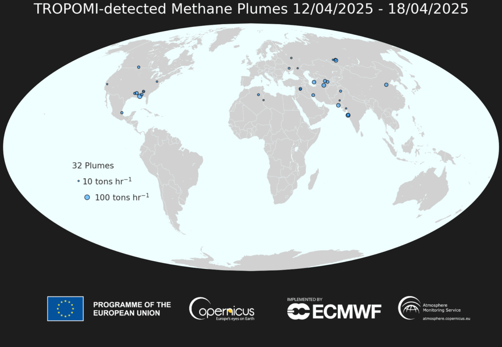
Methane Plume Map
We use the Dutch space instrument TROPOMI onboard Sentinel-5P to automatically detect large methane emission plumes across the globe. The machine-learning technology for this is described in Schuit et al. (2023). The world maps show approximate source locations based on single TROPOMI plumes and initial source rate estimates calculated using an automated mass balance method.
Go to all methane plume maps